United States Northeast

Connecticut, Delaware, Maine, Maryland, Massachusetts, New Hampshire, New Jersey, New York, Pennsylvania, Rhode Island, Vermont, Virginia, Washington, D.C., West Virginia
I have done a TON of research on this and your site is by far the best source for these maps.
Fin - Colorado, USA
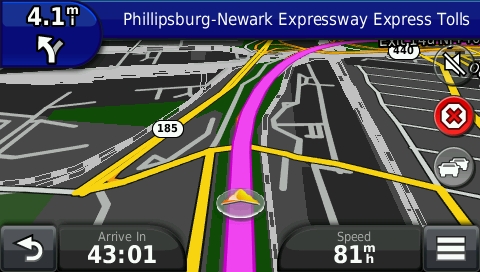
screenshot from GPS showing map of United States Northeast

Features

  • Turn-by-turn directions
  • Address search
    Uses official government address data
    just like the big guys. More Info
  • Searchable POIs
  • Updated weekly
BitTorrent Downloads
Map for SD Card
• 1.0 GB
Installer for BaseCamp and MapSource
• 1010 MB
Direct Downloads
Make a donation to enable direct downloads and gmap for BaseCamp.
Map for SD Card
• 1.0 GB
Installer for BaseCamp and MapSource
• 1010 MB
gmap for BaseCamp
• 1.1 GB
Latest Updates & Fixes
  • Moved Delaware, Maryland, Washington, D.C., Virginia and West Virginia from US South to US Northeast map.
  • Improved compatibility with Garmin GPSMAP handheld devices.
  • Added an SD Card version of the US map as a zip file that contains all of the US regions.
  • Changed "Internet (wlan)" to more understandable "Internet (wifi)".
  • Updated to 2024 US Census TIGER data for improved address search.
Improve this Map
Correct errors in the OpenStreetMap data